Parish Boundaries
<< Back to Parish Information
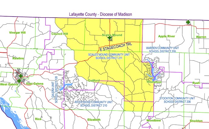
| North: | Starting at the intersection of North Road and the Illinois/Wisconsin state line: east on the Illinois/Wisconsin state line to the Scales Mound Community Unit School District 211/Warren Community Unit School District 205 boundary line. |
| East: | Starting at the intersection of the Illinois/Wisconsin state line and the Scales Mound Community Unit School District 211/Warren Community Unit School District 205 boundary line: south along on the Scales Mound Community Unit School District 211/Warren Community Unit School District 205 boundary line to the Scales Mound Community Unit School District 211/Stockton Community Unit School District 206 boundary line; south on the Scales Mound Community Unit School District 211/Stockton Community Unit School District 206 boundary line to the Thompson/Woodbine township line. |
| South: | Starting at the intersection of the Scales Mound Community Unit School District 211/Stockton Community Unit School District 206 boundary line and the Thompson/Woodbine township line: west on the Thompson/Woodbine township line to the Guilford/Thompson township line. |
| West: | Starting at the intersection of the Thompson/Woodbine township line and the Guilford/Thompson township line: north on the Guilford/Thompson township line to Menzemer Road; west on Menzemer Road to Rawlins Road; west on Rawlins Road and West Guilford Road to North Ford Road: north on North Ford Road to North Hill Road; north on North Hill Road to West Council Hill Road; north on West Council Hill Road to West East Road; west on West East Road to North Road; north on North Road to the Illinois/Wisconsin state line. |